Paradise for Ski Tours
Through the silence of the winter landscape
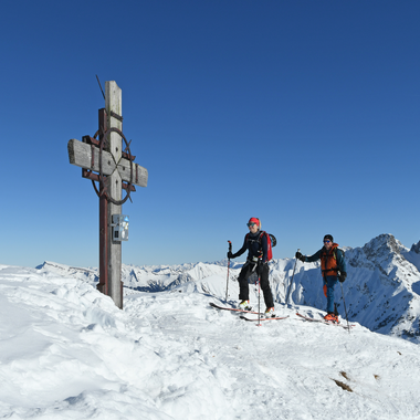
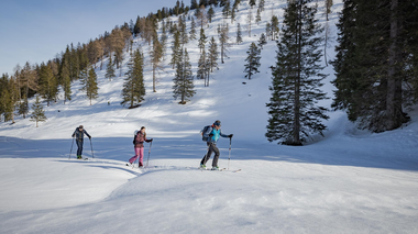
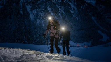
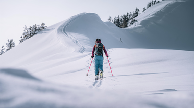
Climb the mountain in peace and quiet and enjoy the tranquillity of the winter landscape, then ski down fantastic deep-snow slopes. There are numerous opportunities for unforgettable ski tours in the Alpenregion Vorarlberg. The effort of the ascent is rewarded with a fantastic view of the mountain panorama and the exhilarating feeling of happiness on the descent. An absolute highlight is certainly the challenging tour for experienced athletes to the highest peak in the Rätikon, the Schesaplana at over 2,900 meters above sea level. But you don't have to go that high to enjoy great outdoor experiences. There are numerous other routes for every fitness level.
Selected ski tours
Further tours (for advanced riders)
Tour suggestions Brandnertal
Schesaplana, 2.965 m | Brand
Starting point: after the end of Brand, 1,120 m
Altitude: 1,850 m
Difficulty: medium
Avalanche risk: high
Season: February - May
The ski tour to the highest peak in the Rätikon is considered an absolute highlight. The very long, physically demanding tour with several steep sections is rewarded with a magnificent panoramic view from the summit.
On the road from the Innertal valley to the valley station of the Lünerseebahn cable car. Continue to the end of the valley and follow the right-hand gully to the level of the summer trail. Mostly without skis over the Bösen Tritt and the subsequent steep flank to the Lünersee. The further ascent is via the western Lünersee accompanying trail. From the middle of the Lünersee, you can start crossing the flank in good conditions. The trail climbs gently into a hollow that leads to the Totalphütte. After the Totalphütte, follow the left ridge to the Schesaplana Grenzrücken. Follow this, then turn right into the ravine and steeply up to the summit ridge just to the left of the highest point. The last few meters are mostly on foot to the summit cross. Descent as ascent.
Oberzalimkopf, 2.340 m | Brand
Starting point: Palüdbahn valley station, 1,060 m
Altitude difference: 1,280 m
Difficulty: medium
Avalanche risk: medium in steep hollow; high below the summit
Season: January - April
Initially on the piste approx. 270 m uphill to the valley floor of the Untere Zalimalpe. Then follow the goods road on the left side of the valley to the crossroads at the entrance to the Zalimtal valley. From here, continue along the left-hand goods road into the valley. After the wooded, lowest section, ascend along the wide valley floor. At the head of the valley, cross an increasingly steep hollow to just below the Oberzalimhütte hut and cross to the right on a flat ascent. From the hut, which is not open in winter, continue to the right and on the right side of a mountain pine-covered ridge onto a small shoulder. Now cross to the left into a steep hollow and ascend this until you reach the ridge to the right of the summit structure. Ski depot under the ridge rocks. Now follow the ridge - immediately after a rocky upswing on the left - to the summit. Descent as ascent.
Schiller syncline, 1,847 m | Bürserberg
Starting point: Einhornbahn valley station or Tschengla hiking parking lot, 1,200 m
Altitude: 630 m
Difficulty: easy
Avalanche risk: low - medium (due to the final slope to the Joch)
Season: December - March
From the Tschengla hiking parking lot, follow the road to the foot of the slope at approx. 1,230 m. Over the mostly open slopes, keep slightly to the right into the Furkla valley, approx. 1,600 m. On the right side of the small valley between Schillerkopf and Mondspitze to below the yoke and at the end in hairpin bends steeply onto the ridge or more comfortably onto a small shoulder on the northern slope of the Schillerkopf. Descent as ascent.
Alternative: Mondspitze, 1,967 m
The Mondspitze is more interesting in late winter due to the heavy mountain pine growth. Take the same route as to the Schillermulde until you reach the ridge. Then head straight for the east ridge of the Mondspitze and head just left of the ridge in hairpin bends to the summit. Descent as ascent.
Tour suggestions Großes Walsertal
Starting point: Marul church
Elevation gain: 760 m, 8.9 km
Duration: 2.5 - 3 h
Difficulty level: easy
The tour starts to the left of the church in Marul and climbs up the steep slope. Before you reach the last houses in the village, keep right and cross the road. The first destination is the Stafelfederalpe at 1,472 m above sea level. The route continues northwards, reaching the ridge towards Kellerspitze after approx. 300 m.
Descent: as ascent
Starting point: Faschina village center
Altitude difference: 641 m, 3.2 km
Duration: approx. 2.5 h ascent
Difficulty: medium, difficult in the upper part
Refreshment stops: Hotels and inns in Faschina, Franz Josef Hütte
Relatively short, but beautiful and not to be underestimated (summit ridge) ski tour. From the center of Faschina to the slopes to the west and over these to the Stafel Alpe and the so-called Glatthornbahn (4-seater chairlift). Shortly before the lift, turn left across the stream. Overcome the steep step at the start, which is covered in mountain pines, in a left-right loop and then easily reach the final slope via a ramp and up to the saddle on the south-west ridge. Ski as high as possible along the ridge, then walk the last few meters along the narrow ridge to the summit.
Starting point: tunnel below the village of Faschina
Altitude difference: 783 m, 4.6 km
Duration: 2.5 - 3 h ascent
Difficulty: medium
Refreshments available: Hotels and inns in Faschina
The trapezoidal Zafernhorn, located to the east above Faschina, is often visited by ski tourers throughout the winter. The starting point is the tunnel below the village of Faschina (1,375 m). The tour leads along the forest path to the Zafera Maisäß huts.
From the Maisäß huts to the foot of the mountain and keeping slightly to the right towards a ramp that is also used as a summer path. Over this on the shoulder in the south-east ridge (chapel) and on the mostly blown-off grassy ridge to the summit. Caution: often large cornices on the right-hand side!
Descent: roughly the same as the ascent
Starting point: Sonntag-Stein cable car
Elevation gain: 1,243 m, 10.6 km
Duration: 5 h
Difficulty level: medium
Refreshment stops: Inns in Sonntag, Stuba cable car, Alpen Chalet Partnom
From Sonntag, take the cable car to Stein. From here, ascend into the valley towards Steinbild, Unterpartnom, Oberpartnom in a south-easterly direction to the Garmilsattel (1,810 m). Now take the goods road to the south-east, initially flat, then descending through the increasingly steep forest to the Laguzalpe (1,584 m). Continue in the direction of Obere Laguzalpe. Shortly before the Alpe, ascend to the Schwarze Furka and from there, first on skis, then on foot to the summit (1,140 m).
Descent: same as ascent
Elevation gain: 1,628 m, 8.4 km
Duration: approx. 5 h
Difficulty: difficult
Refreshments available: Inns in Buchboden
From Buchboden, the tour leads via Bad Rothenbrunnen up to the Gadenalpe (1,317 m) and further east to the Mutterwangjoch (2,025 m), descending a little to the east from the pass. From here you can climb the Bratschenkopf from the east. Follow the 2,000 m contour line eastwards under the rocks of the Bratschenwand to the Gamsboden. Climb up the eastern slope to the rarely climbed Bratschenkopf.
Descent: From the yoke or from the summit, keep left along the foot of the Feuerstein wall. Then the beautiful eastern slopes (beware of avalanches) to the lower Alpschellenalpe and Metzgertobelalpe to Buchboden.


