
Damüls Fontanella I Türtschalpe und Alpe Unterdamüls
Distance12,1 km
Elevation gain720 m
Negative altitude478 m
LevelModerate
Duration3:00 h
Distance12,1 km
Elevation gain720 m
LevelModerate
Duration3:00 h
A short moment
Loading map...
Damüls Fontanella I Türtschalpe und Alpe Unterdamüls
Fontanella - Türtschalpe - Alpe Unterdamüls - Kirchdorf Damüls
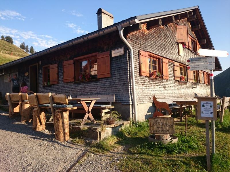 Alpe Unterdamüls
Route description
Start: Fontanella Dorfzentrum
End: Damüls Kirchdorf
Startend in Fontanella geht es hinauf zur Türtschalpe. Von dort aus kann noch auf das Türtschhorn gelaufen werden. Weiter geht es zur Alpe Unterdamüls, bis der Weg schlussendlich im Kirchdorf Damüls endet.Properties
- Linear route
- Refreshment stops available
- Family-friendly
Emergency services
140 Alpine Emergencies throughout Austria
144 Alpine Emergencies Vorarlberg
112 Euro emergency call (works with any mobile phone/network)