
Furkla high altitude hiking trail | Bürserberg
Distance10,2 km
Elevation gain131 m
Negative altitude104 m
LevelModerate
Duration3:00 h
Distance10,2 km
Elevation gain131 m
LevelModerate
Duration3:00 h
A short moment
Loading map...
Furkla high altitude hiking trail | Bürserberg
From the mountain station of the Panorama cable car, the winter hiking trail leads gently uphill to the Parpfienzsattel. From there with a slight downward slope and slight upward slope via the high trail to the Furkla Alpe. Return via the same path.
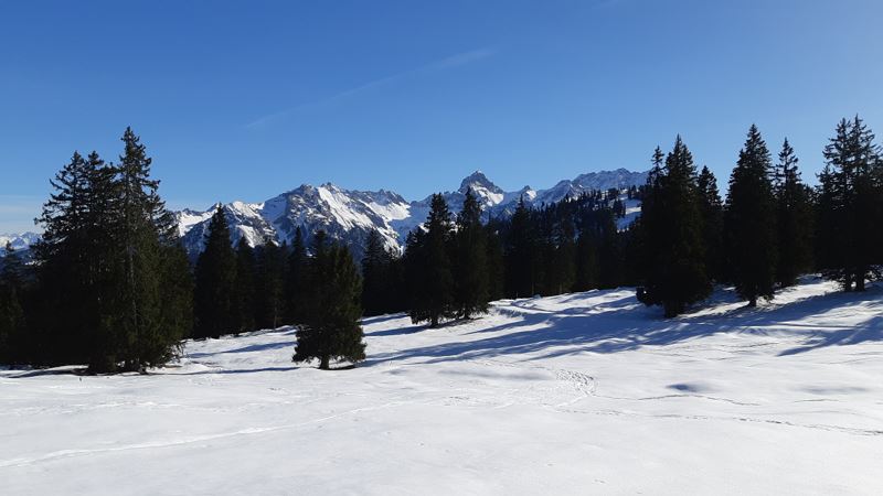 Ausblick entlang des Furkla-Höhenwanderweges
 Ausblick Richtung Bludenz und Großes Walsertal
- Möglichkeit für eine Rast bei der Alpe Furkla (Alpe im Winter geschlossen)
- Auf dem Rückweg Richtung Panoramabahn Bergstation


Equipment
Sturdy shoes, warm clothing and walking sticks are recommended. Cell phone in case of emergency.
Route description
Start: Panoramic cable car mountain station, Bürserberg
End: Panoramic cable car mountain station, Bürserberg
Dorfbahn valley station, Brand - ascent with the Dorf- and Panoramabahn cable car - Panoramabahn mountain station, Bürserberg - Parpfienzsattel - Furkla high-altitude trail - Furkla Alpe - optional Garsellijoch - same route backProperties
- Scenic
- Out and back
- Refreshment stops available
- Groomed snow
Emergency services
140 Alpine Emergencies throughout Austria
144 Alpine Emergencies Vorarlberg
112 Euro emergency call (works with any mobile phone/network)