
Hochgerach, 1.985 m | Thüringerberg
Distance15,4 km
Elevation gain1109 m
Negative altitude1145 m
LevelDifficult
Duration6:15 h
Distance15,4 km
Elevation gain1109 m
LevelDifficult
Duration6:15 h
A short moment
Loading map...
Hochgerach, 1.985 m | Thüringerberg
From the center of Thüringerberg, the trail leads over the Außerberg and the Kapiescha district up to the Inner Alpila Alpe. From here it is still about 400 m of ascent to the summit of Hochgerach. A head for heights and surefootedness are required for the ascent of the summit. The descent leads the first part over the same path and then over the Äußere Alpila Alpe and the Gampelin Alpe. Via the Außerberg back to the starting point in Thüringerberg.
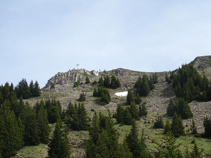 Unterhalb des Hochgerachs
 Ausblick vom Hochgerach
- Frühlingsboten am Hochgerach
- Wanderwegenetz Vorarlberg


Equipment
Ankle-high hiking boots with treaded soles, sun and rain protection, snack, filled water bottle, first aid kit and hiking poles are recommended. Mobile phone in case of emergency.
Route description
Start: Village center, Thüringerberg
End: Village center, Thüringerberg
Thüringerberg - Außerberg - Kapiescha - Innere Alpila Alpe - Hochgerach - hiking trail via Äußere Alpila Alpe - Gampelin Alpe - Außerberg - ThüringerbergProperties
- Scenic
- Summit route
- Round trip
- Ridge
Emergency services
140 Alpine Emergencies throughout Austria
144 Alpine Emergencies Vorarlberg
112 Euro emergency call (works with any mobile phone/network)