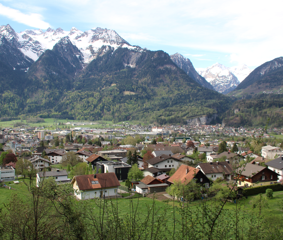
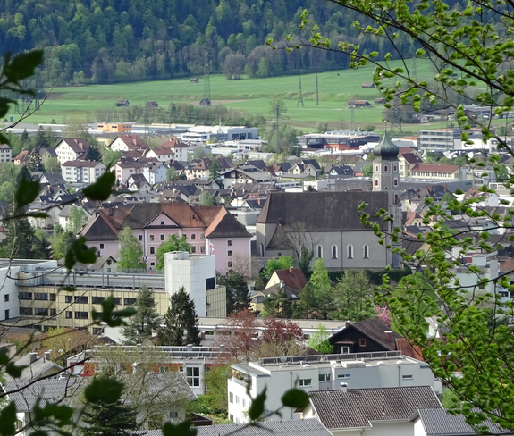
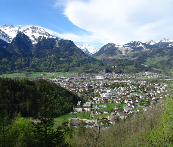
Sunna-Weg: Stage 2 | Bludenz
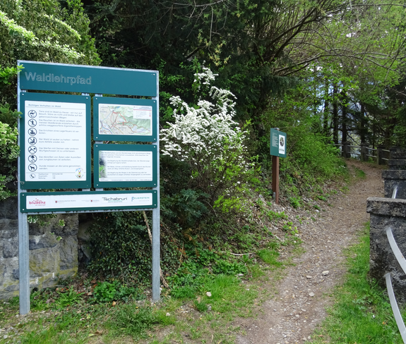
Easy
Refreshments
Panoramic
Cultural / Historical
Stage tour
Themenweg
01:30 h duration
3,98 km Length
833 m Highest point
661 m Lowest point
244 m Ascent
73 m Descent
Condition
Difficulty
Result
Landscape

Tour description

Along the municipalities of Nüziders, Bludenz and Braz, a cultural-historical theme trail, the "Sunna Trail", has been inspiring visitors since summer 2019. The second stage leads from the Daneu bridge in Bludenz to Rungelin.
Description

The "Sunna Weg" gets its name from its location on the sunny side of the valley and its course through the Sonnenberg community of Nüziders. Nüziders was once the ancestral seat of the county of Sonnenberg. On this hiking trail close to the town, 25 panels provide information with cultural-historical focal points. They also cover scenic, natural history and geological topics. The focus is always on conveying stories about people and the landscape.

Stage 2

The second stage of the theme trail runs from the Daneu bridge in Bludenz to the Rungelin district in Bludenz. The start and end points and all entry points have been chosen so that they can be easily reached by public transport. Along the way, numerous loungers and benches invite you to enjoy the view of the surrounding mountains.

Approach
Public transport
Access:

City bus line 501, stop "Nüziders Oberdaneu" or "Bludenz Obdorfweg"

Possible entry/exit: City bus line 503, stop "Stadion/Freizeitbad Val Blu"

Exit: City bus line 503, stop "Rungelin"

Timetable query online at www.vmobil.at

Parking

Parking lot at the cable car Muttersberg in Bludenz or different parking lots in Bludenz

Directions
Stage 2

The tour starts at the Daneu bridge in Bludenz. At the moated castle, the forest trail starts along the forest nature trail in the direction of Hinterebene. Along the way you always have the opportunity to take a short break or enjoy the sensational views of Bludenz. On the Hinterebene there is a larger rest area and several vantage points. From here you continue to follow the forest path in the direction of Rungelin. Above Rungelin - at Hellwald - the path branches off in the direction of Rungelin and you reach the end point of the second stage.

Route

Daneubrücke, Bludenz - moated castle - forest nature trail - Hinterebene - Lawils - Hellwald - Rungelin, Bludenz

Possible access and descent

- shortly before Hinterebene direction Montikel/city center

- shortly before Hinterebene direction Montikel/swimming pool Val Blu

- at Ferdinand-Gassner-Höhenweg direction Halde/swimming pool Val Blu

Safety instructions
EMERGENCY CALL

140 Alpine emergencies Austria-wide
144 Alpine emergencies Vorarlberg
112 Euro-emergency call (works with any mobile phone/network)

www.alpenregion-vorarlberg.com/sicherheitstipps-wandern

Equipment

Ankle-high shoes with treaded soles, sun and rain protection, snack, filled water bottle and first aid kit. Mobile phone for emergencies.

Tips

Along the second stage you will also find the interestingly designed Bludenz forest nature trail.

Destination

Rungelin, Bludenz

Starting Point

"Daneu" bridge, Bludenz

Sicherheitstipps für Wandern in Vorarlberg

EN NOTRUF:

EN 140 - Alpine Notfälle österreichweit 

EN 144 - Alpine Notfälle Vorarlberg 

EN 112 - Euro-Notruf (funktioniert mit jedem Handy/Netz) 

Characteristics
Tour type Themenweg
Difficulty Easy
Elevation profile
Best time of year
Jan
Feb
Mar
Apr
May
Jun
Jul
Aug
Sep
Oct
Nov
Dec