Wäldletobel trail Klösterle am Arlberg
800 years of living history above Klösterle am Arlberg
Are you currently on the Wäldletobel trail in Klösterle am Arlberg? You can find further information, pictures and interviews with contemporary witnesses for each information station below.
Station 1: On the trail of history
Below you will find the route of the Wäldletobel Trail as well as a suggestion for the return route as a circular hike.
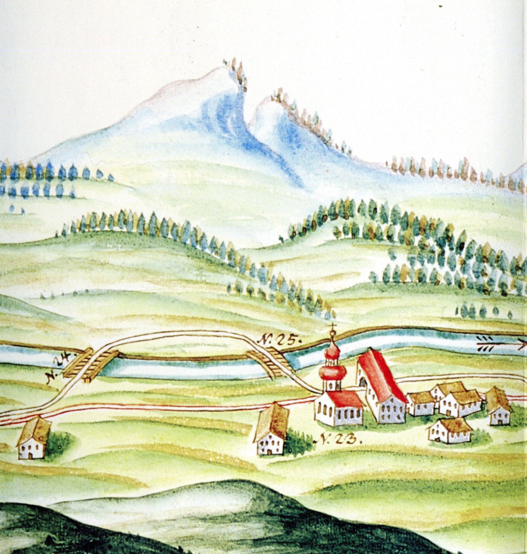
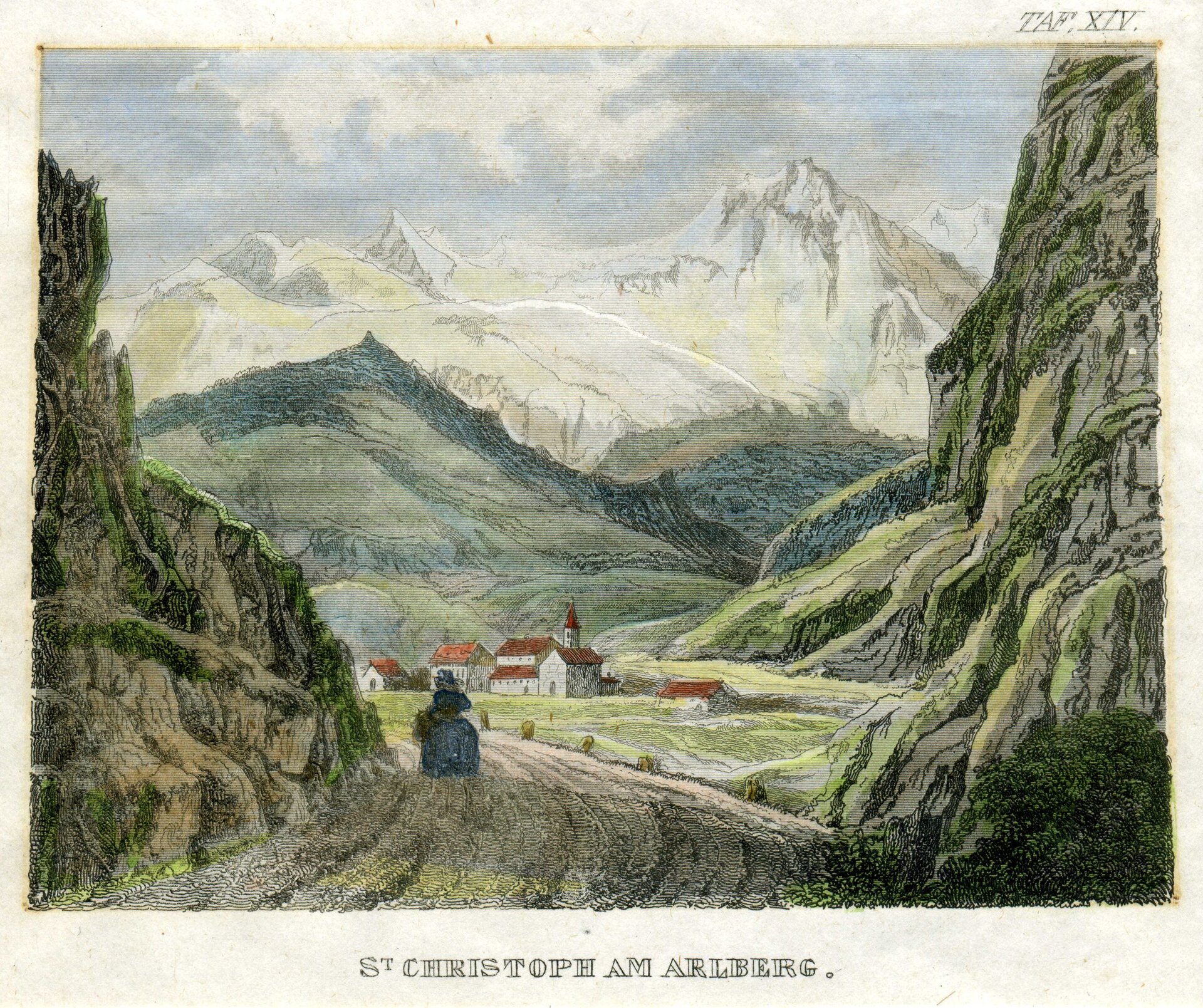
Station 2: Klösterle and its history
From the story
Although prehistoric finds prove that the Arlberg was used early on, it is questionable whether people lived in the area permanently. Pollen analysis studies at least prove that the area has been used for alpine farming for thousands of years.
However, there is also some uncertainty regarding the settlement of the monastery valley in the Middle Ages. The valley was first mentioned in a document in 1218, when Count Hugo I von Montfort donated a chapel dedicated to St. Mary and "the forest facing the Arle" to the Order of St. John. It is not clear from the document whether this chapel already existed in Klösterle. The Knights of St. John subsequently built a hostel where they offered accommodation to pilgrims, crusaders and merchants.
The chapel of St. Mary seems to have become too small over time, which is why a new building was constructed in 1332. The new church was consecrated in honor of the Mother of God and John the Baptist, which again shows the importance of the Knights of St. John. Over time, the village was given the name "Klösterle" and the entire valley the name "Klostertal". It is not clear from the sources how long the Knights of St. John were active in Klösterle. The Klostertal came into the possession of the Werdenberg family after the division of the House of Montfort in 1258; the Montfort family may have lost interest in promoting the hospice after losing their possessions east of the Arlberg.
A document from 1424 mentions a "Hochhaus" (term for an office building), which according to the description of the location was probably the abandoned monastery building. This is mentioned for the last time in 1509 as "hoch hus by der kirchen".
According to the chronicle of priest Mathias Sander, the Johanniter monastery (and therefore probably also the tower block) stood below the sacristan's house and its ruins were visible until 1717. A certain Ignaz Freytag would have built a new house on that site in that year.
The former inn "Johanniterstube" is said to have served as a farm building for the monastery and was once connected to the house opposite, no. 71, by an archway (arbour). This arch was demolished in 1823 when Arlbergstraße was extended. The administrator or vicar of the hospice and hospital would have lived in this house (the old calendar from the 16th century still mentions a vicarage). The manorial customs office was also housed in the house south of the street. A customs office in Klösterle is first mentioned in documents in 1343. From the 17th century, the Friz family were the owners of the customs office, from 1674 as imperial customs officers.
Station 3: Klostertal mountain forests
European nature reserve Natura 2000
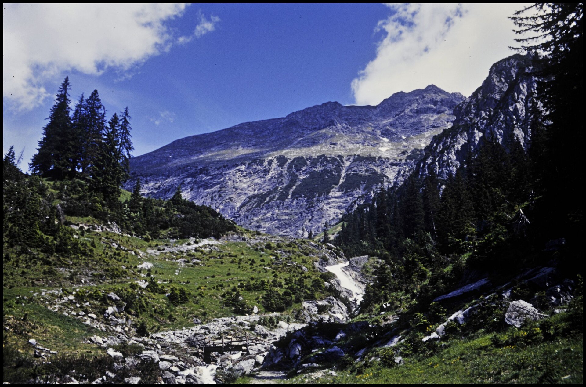
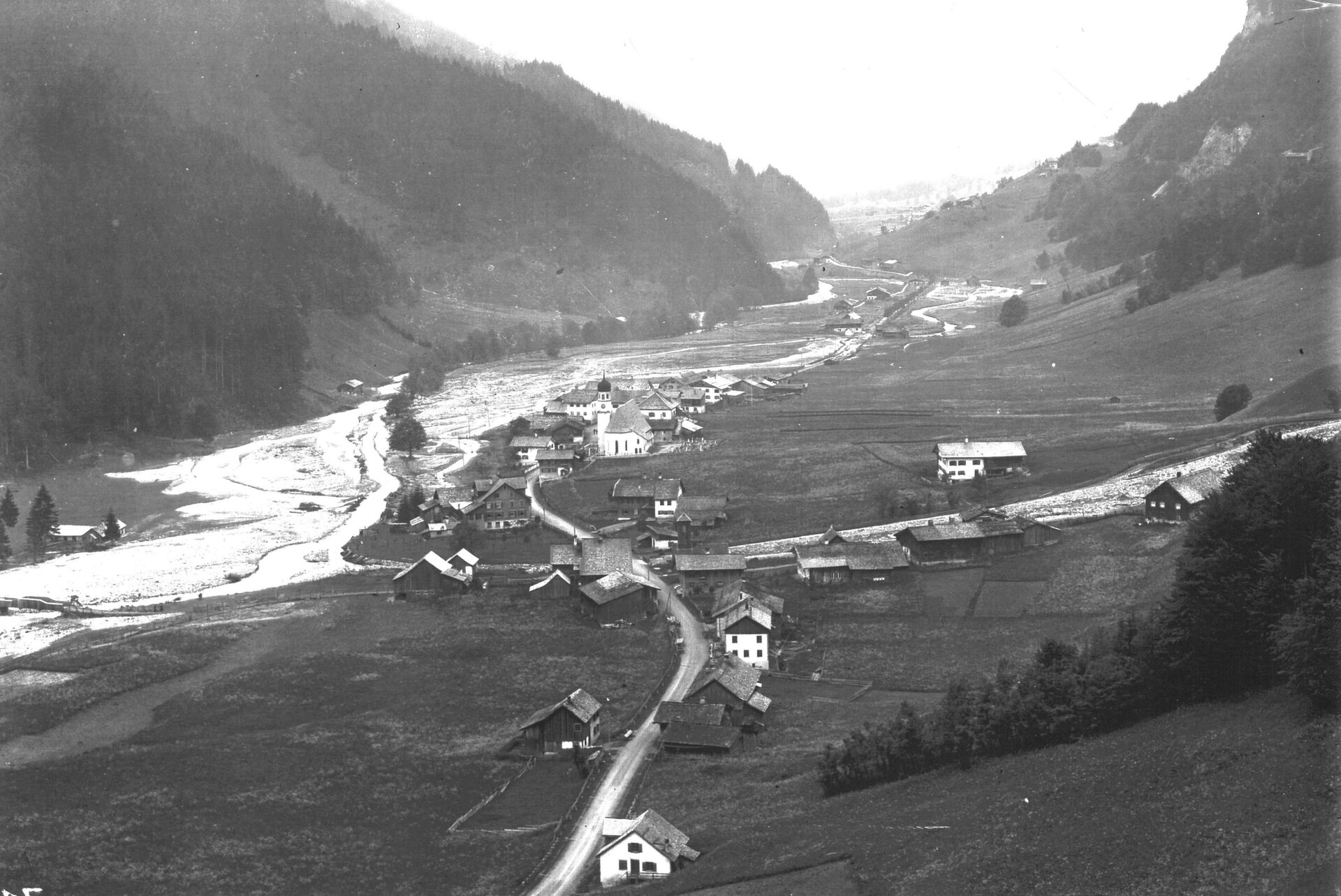
As soon as you enter the Klostertal, you are greeted by an imposing and richly structured mountain landscape - rugged mountain peaks, steep torrents, spectacular waterfalls and intertwined forests and meadows give the Klostertal its truly unique character.
The Klostertal mountain forests stretch like a ribbon on the sunny side of the Klostertal from Bludenz to Langen am Arlberg. Steep forests with plenty of dead wood and colorful meadows characterize the landscape. The "untidy forests", in which dead trees are sometimes still present in large numbers, offer the best conditions for a variety of highly specialized species. The most prominent of these are probably the various woodpeckers. A large number of rare and sometimes protected species, such as the colorful orchids, thrive on the flower-rich meadows. It also hums and buzzes with the activity of insects and other small animals.
The close interlocking of near-natural forests and extensive meadows creates a particularly rich habitat for a wide variety of creatures. From lichens and mosses to rare thermophilic plants, endangered birds and shy mammals.

Klostertal mountain forests
Vorarlberg's natural diversity: All the facts and information about the Klostertal mountain forests European nature reserve, protected assets, typical and rare species of animals, plants and habitats, tips for visitors to the area and much more.
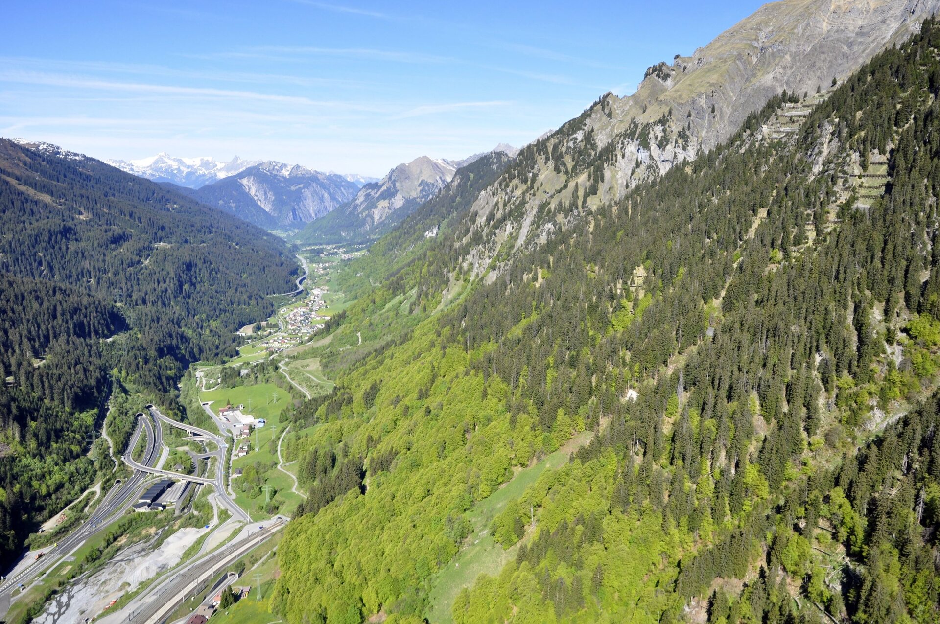
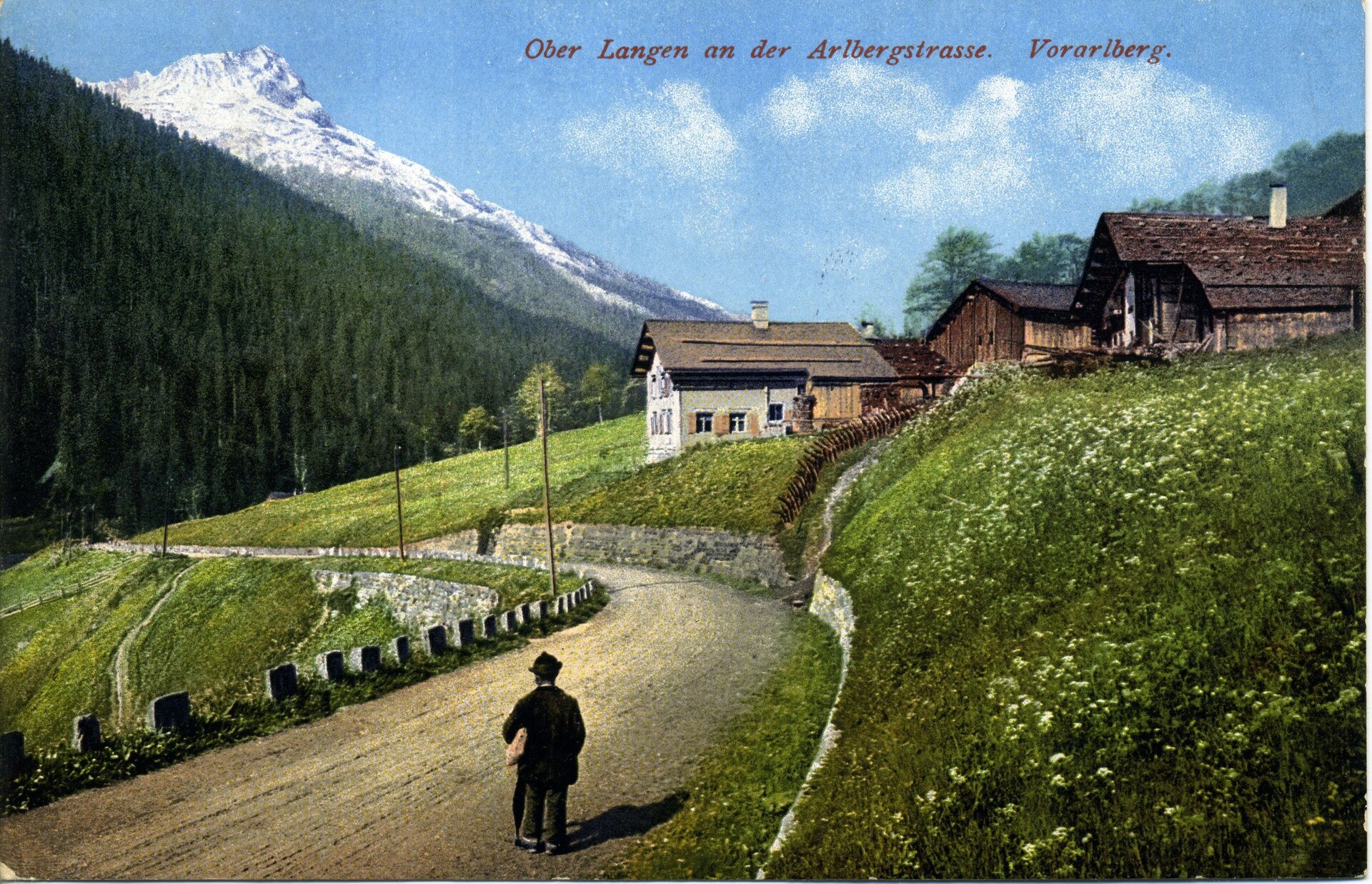
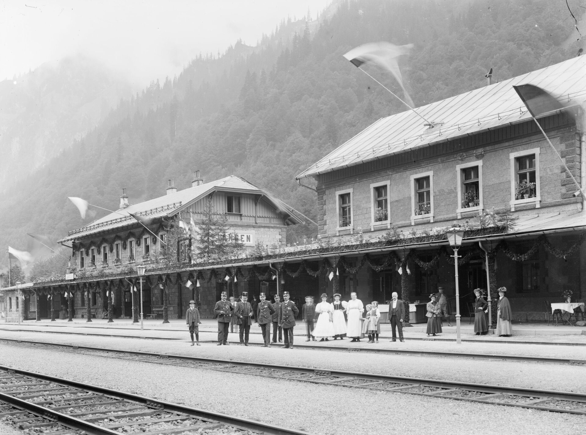
Station 4: Traffic over the Arlberg
Shaping settlement development in the Klostertal valley
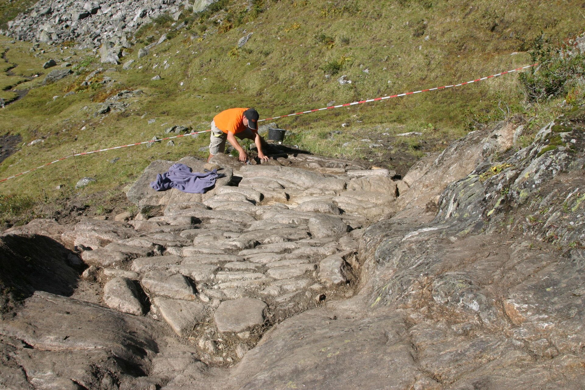
Since time immemorial, today's municipality of Klösterle has been linked in a special way to traffic over the Arlberg. Customs offices, inns and the activities of muleteers and carters or "snow breaking" were important elements of economic development. The expansion of Arlberg traffic led to the establishment of the monastery mentioned in the document from 1218. Statements about Arlberg traffic and settlement pioneers before this time can only be made on the basis of archaeological investigations. It is obvious that the attention that the Arlberg received from the 13th century onwards led to an increase in traffic and the expansion of the route. New salt deposits were discovered in Hall at this time, which boosted the salt trade and east-west traffic. An expansion of the Arlbergweg and the first collection of tolls are mentioned in 1312.
This medieval road over the Arlberg was partially uncovered during archaeological investigations between 2005 and 2008 as well as in 2011. A hiking trail now leads over the historic tracks.

Despite the expansion of the roads, crossing the Arlberg remained dangerous, especially in winter. In order to offer help to travelers in distress, Heinrich Findelkind built a hostel on the Arlberg in 1386, following the example of other Alpine passes. In the first seven years alone, he and his helpers were able to save the lives of 50 people. In order to complete the hospice and build a chapel, alms collectors were sent out to collect donations. From 1393, the benefactors were entered with their coats of arms in their own coat of arms and messenger books, three of which have been preserved. Pope Boniface IX supported the collectors, as did numerous bishops, and issued a letter of indulgence in 1398. Contrary to popular belief, however, there was no brotherhood ("fraternitas") to St. Christoph in the Middle Ages.
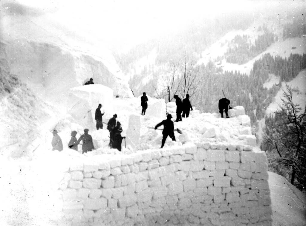
The road over the Arlberg existed until around 1500 and then became a mule track again as the route over the Fernpass was increasingly preferred. In the following centuries, Arlberg traffic declined, although mule traffic remained of considerable importance. In Klösterle, the so-called "Wartesstall" was a reminder of this time of mule traffic over the Arlberg until it was demolished a few years ago. Another task of the inhabitants of Klösterle and Stuben was the so-called "snow breaking". Since the Middle Ages, the road over the Arlberg was kept open in winter wherever possible. A route had to be created for pedestrians, pack animals and sledges if it was safe from avalanches. A so-called "breakage fee" could be collected in Klösterle and Stuben for this.
Until the second half of the 18th century, the path over the Arlberg was in poor condition. All efforts to improve the road had remained unsuccessful until then. It was only Emperor Joseph II who was interested in expanding the Arlberg road for political and military reasons. During his reign, a corresponding project was drawn up in 1782 and in 1785 the road was repaired to such an extent that it could be used by wagons throughout. Above Stuben, a new route was created by blasting at the so-called "Posteck". Soon after the opening, a regular postal connection was introduced in 1796 with a post rider and from 1818 with a driving post. Efforts to expand the Arlberg road continued from 1822.
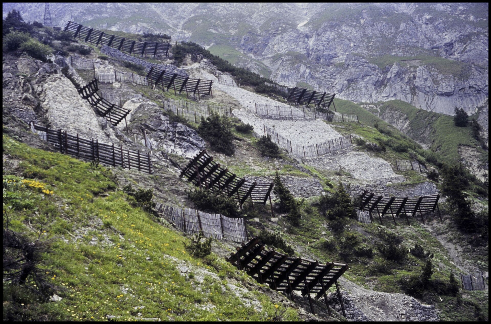
Station 5: Torrent and avalanche control
Influence of the mountain landscape on transportation
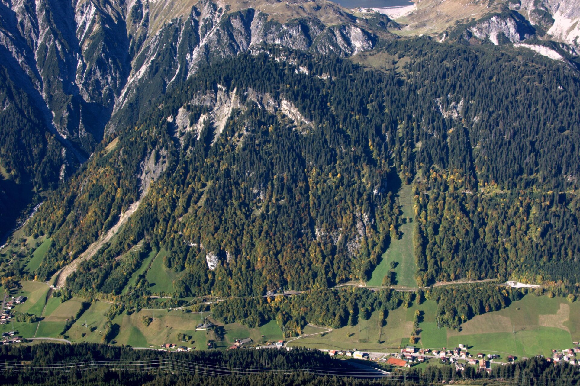
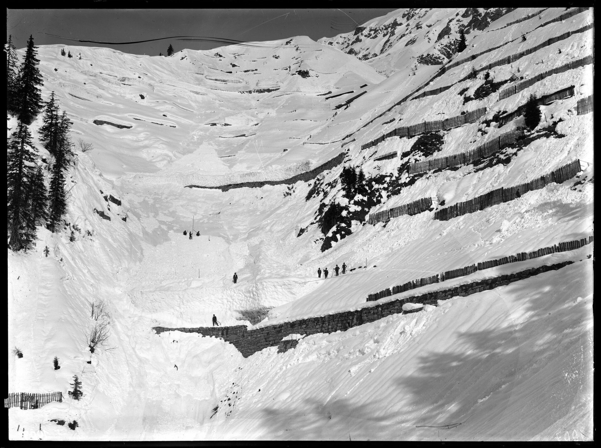
From an international perspective, the influence of the mountain landscape on transportation is more evident in Klostertal than in almost any other region. The natural conditions posed particular challenges during the construction of the Arlberg Railway from 1880 to 1884, as numerous viaducts and tunnels had to be built along the route. While the years of railroad construction were not characterized by any extraordinary weather events, the extent of the danger became apparent in 1888 at the latest in view of the huge amounts of snow and numerous avalanches.
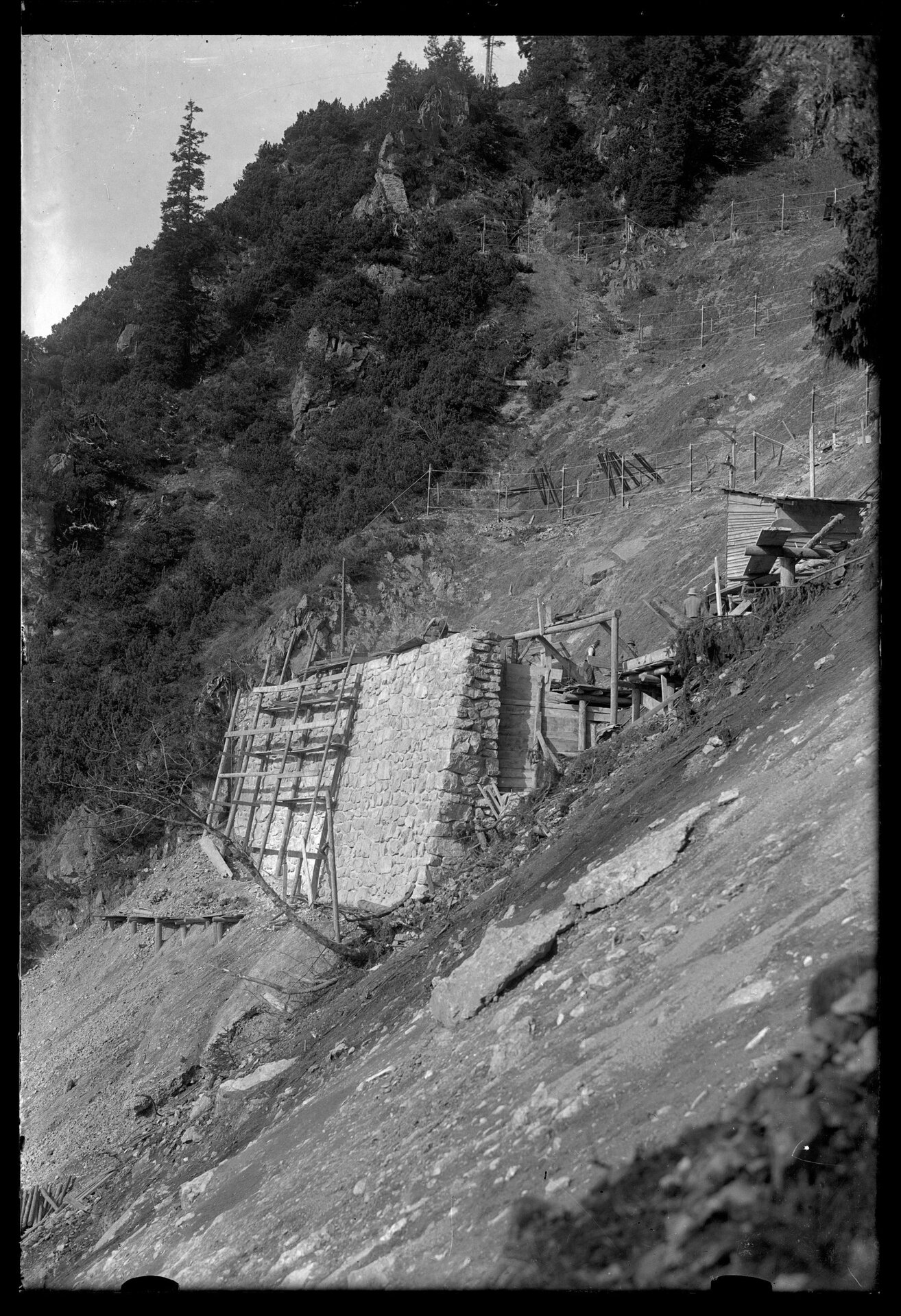
Since the end of the 19th century, torrent and avalanche control in the Klostertal has been further developed over more than 130 years. In no other place is this as clearly visible as on the slopes above Langen am Arlberg, especially on the so-called "Blasegg". This is one of the most important areas in Europe and a kind of open-air museum for the development of avalanche control, which can be seen in systems such as the "Arlberg-Schneerechen". A number of men from the municipality of Klösterle were once employed by the Lehnenpartie, whose task was to protect the railroad facilities. To this end, snow dams were built in winter, for example, while in spring and summer, rocks were cleared and shoring measures were repaired. After 1884, the natural conditions in the Klösterle area led to numerous route changes. With the Großtobel tunnel and the Wildentobel tunnel, large parts of the route were tunneled under even before the First World War. The old railroad line now serves as a hiking trail. In the 21st century, the last section was completed with the Blisadona Tunnel, which means that the Wäldletobel Bridge - a kind of "landmark" of Klösterle - is no longer used today.
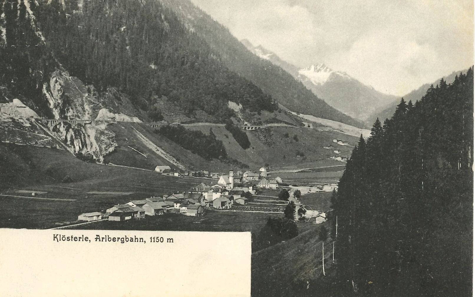
Station 6: Construction of the Arlbergbahn
Klösterle was significantly influenced by the Arlbergbahn
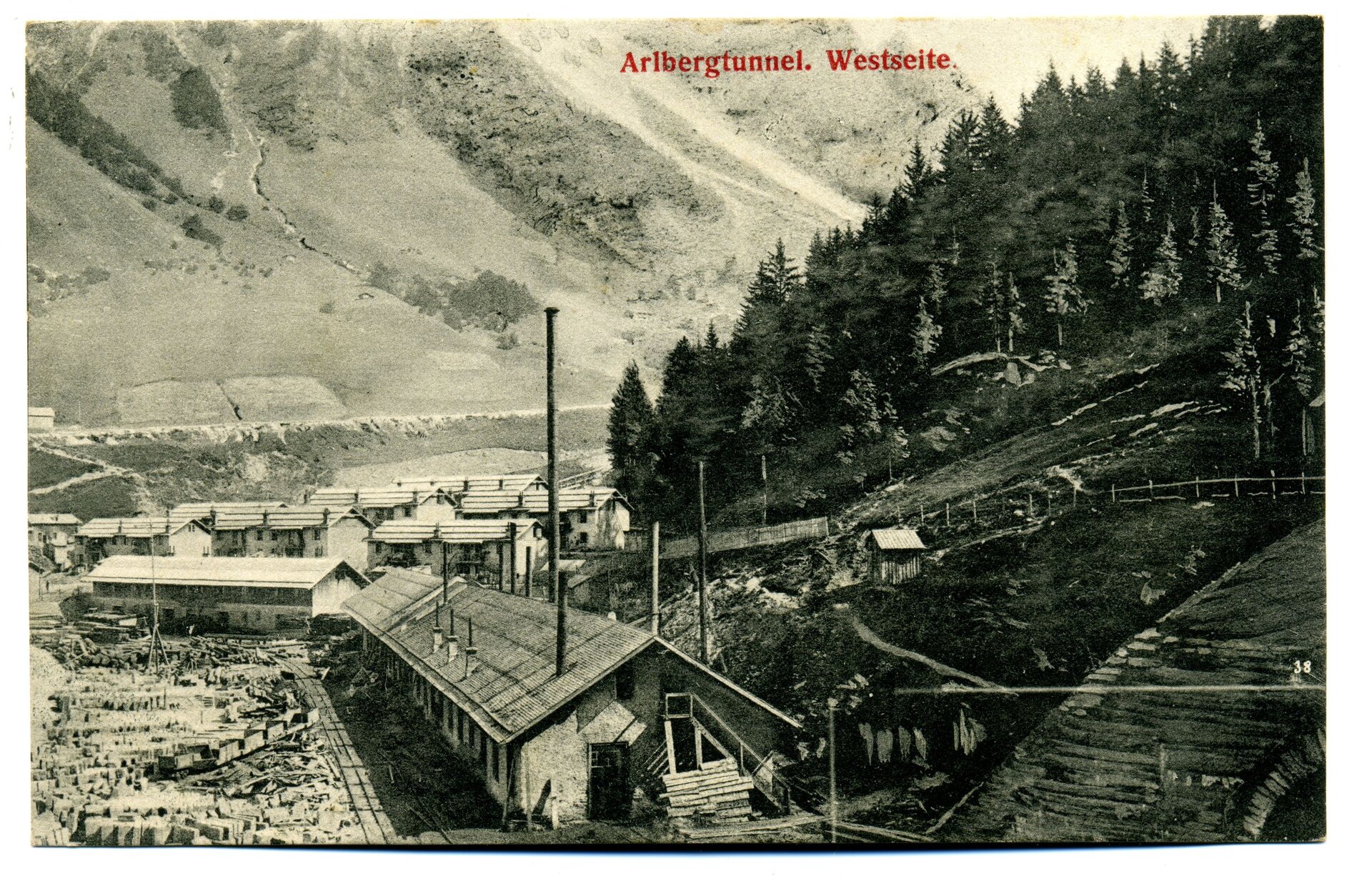
The first plans for the construction of a rail link over the Arlberg date back to the 1840s. Feldkirch industrialist and Chamber of Commerce President Carl Ganahl in particular was a vocal advocate for the construction of a railroad linking Vorarlberg and Tyrol. Concrete plans for the design and construction of the line began in the 1860s and were given an additional boost by the construction of the Vorarlberg Railway, which stretched from Lindau to Bludenz. What followed was an eight-year struggle - a "parliamentary tale of woe", as one author put it. Various route options were conceived and rejected until the solution of a tunnel between Langen and St. Anton was finally chosen. The bill for the construction of the rail link between Innsbruck and Bludenz was sanctioned by the Imperial Council in 1880 and signed by Emperor Franz Joseph.
The construction director of the Arlbergbahn was Julius Lott, born in Vienna in 1836. However, he died in 1883, one and a half years before the work was completed (of tuberculosis, not suicide as is often claimed). The 136.6 kilometer long railroad line from Innsbruck to Bludenz was divided into a 72.8 kilometer long valley line Innsbruck-Landeck, a 27.7 kilometer long east ramp Landeck-St. Anton, a 10.3 kilometer long apex line St. Anton-Langen (the Arlberg tunnel) and a 25.8-kilometre-long western ramp Langen-Bludenz.
Work on the Arlberg tunnel began in St. Anton am Arlberg and Langen am Arlberg in June 1880. The breakthrough of the directional tunnel in the Arlberg tunnel was achieved on November 19, 1883, much earlier than planned. In the last year of construction, the ramp sections in particular were built until a train was finally able to travel the route from Landeck to Bludenz for the first time on September 3, 1884. The ceremonial inauguration by Emperor Franz Josef took place on September 20, 1884. The scheduled operation of the Arlberg Railway began the very next day.
At least as important as the scenic changes brought about by the construction of the Arlberg Railway are the social changes that accompanied this major construction site. The number of workers employed on the Langen side of the Arlberg tunnel reached a peak of 2,689 in October 1883. On the western ramp between Langen and Bludenz, the peak figure was 4,829 men in June 1884. By comparison, the population of Klösterle in 1869, a good decade before the start of construction, was just 526 people. These figures show the enormous challenges that the population of the municipality had to face in view of the tunnel and railroad construction site. In Langen, a separate workers' settlement of houses and barracks was built. In Stuben, Klösterle and Danöfen, whole families of workers were housed in private accommodation. Economic life flourished, not least due to the opening of numerous inns and pubs.

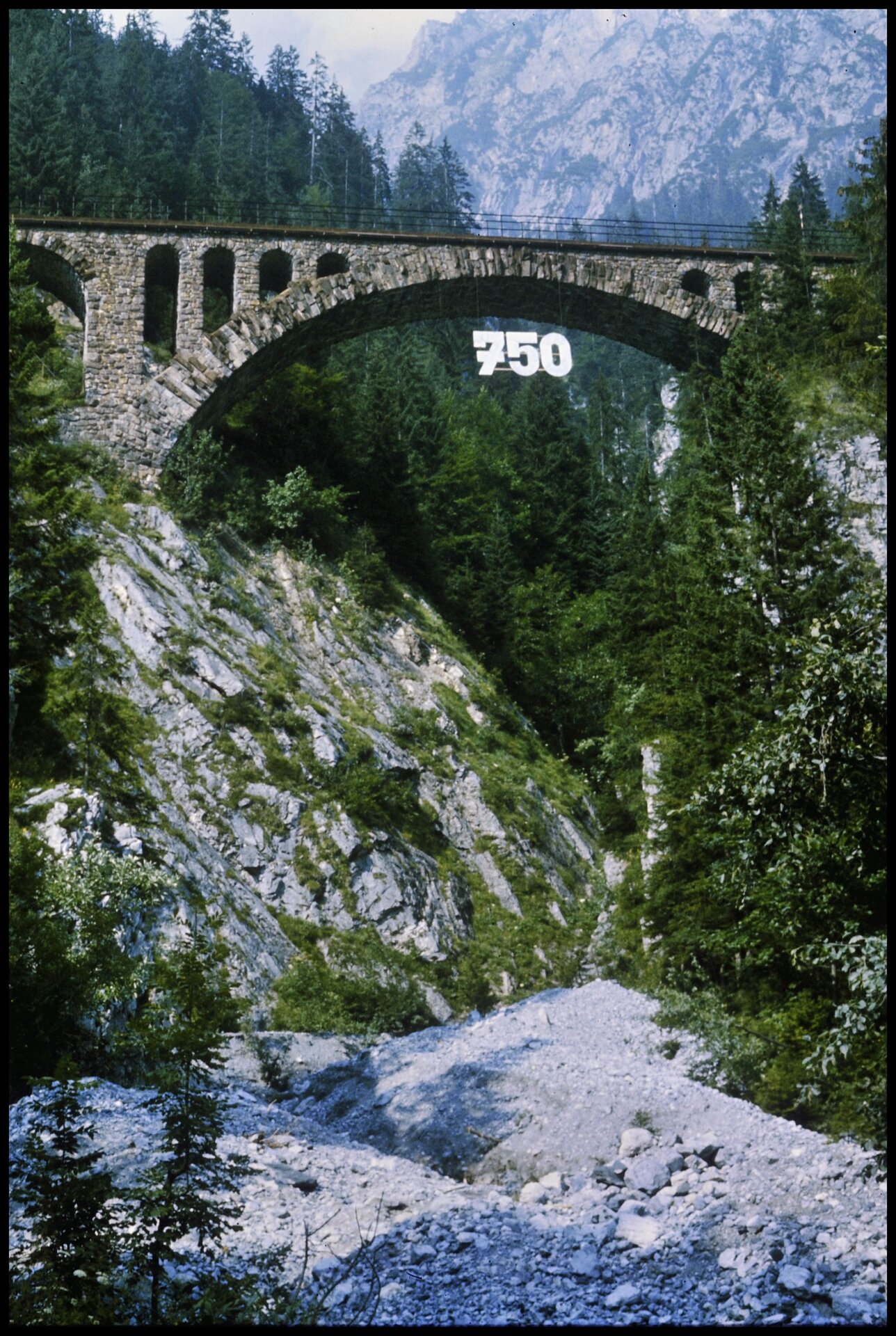
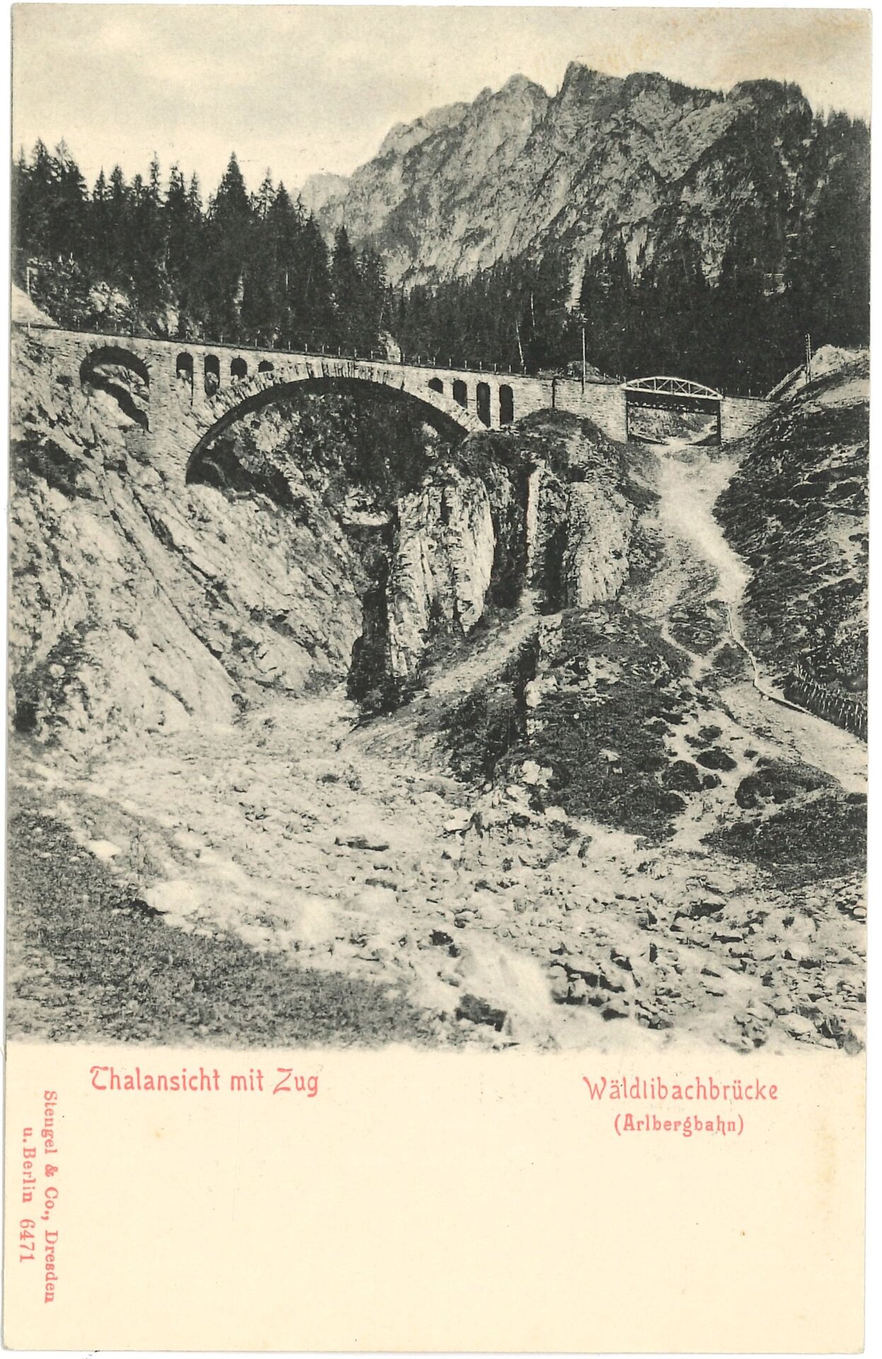
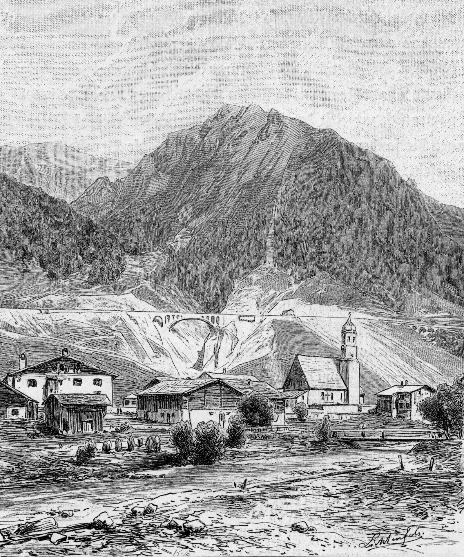
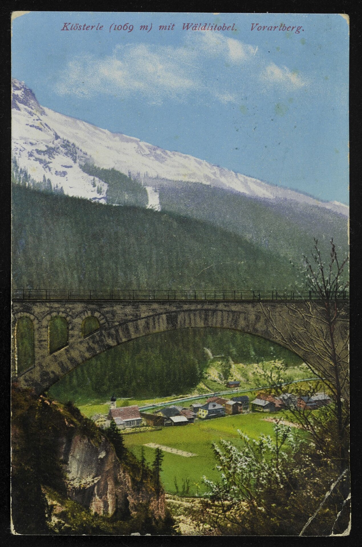
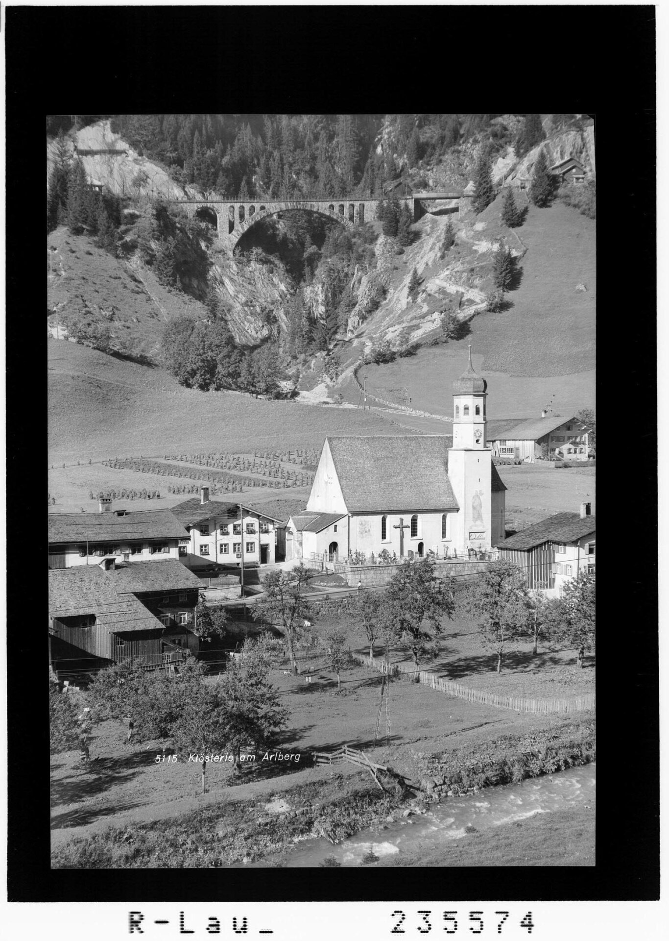
Station 7: Wädletobel Bridge
Landmark of the village
Built between 1880 and 1884, the Arlbergbahn is impressive for its engineering structures. Due to the natural conditions in the Klostertal and Stanzertal valleys, numerous bridges, tunnels and viaducts had to be built. Today, these structures characterize the landscape in a special way. In Klösterle, the Wäldletobel bridge in particular has become a kind of "landmark" for the village due to its location and visibility. The semi-circular bridge spans the Wäldletobel gorge at a width of 114 meters and a height of 56 meters. The bridge was built using local quarrystone masonry. The wooden scaffolding required for this was later used for the construction of the school building in Klösterle. It is an impressive testimony to the craftsmanship involved in building the Arlbergbahn. The Klösterle stop was once located near the bridge. The railroad line was relocated to the Blisadona tunnel just over 20 years ago.
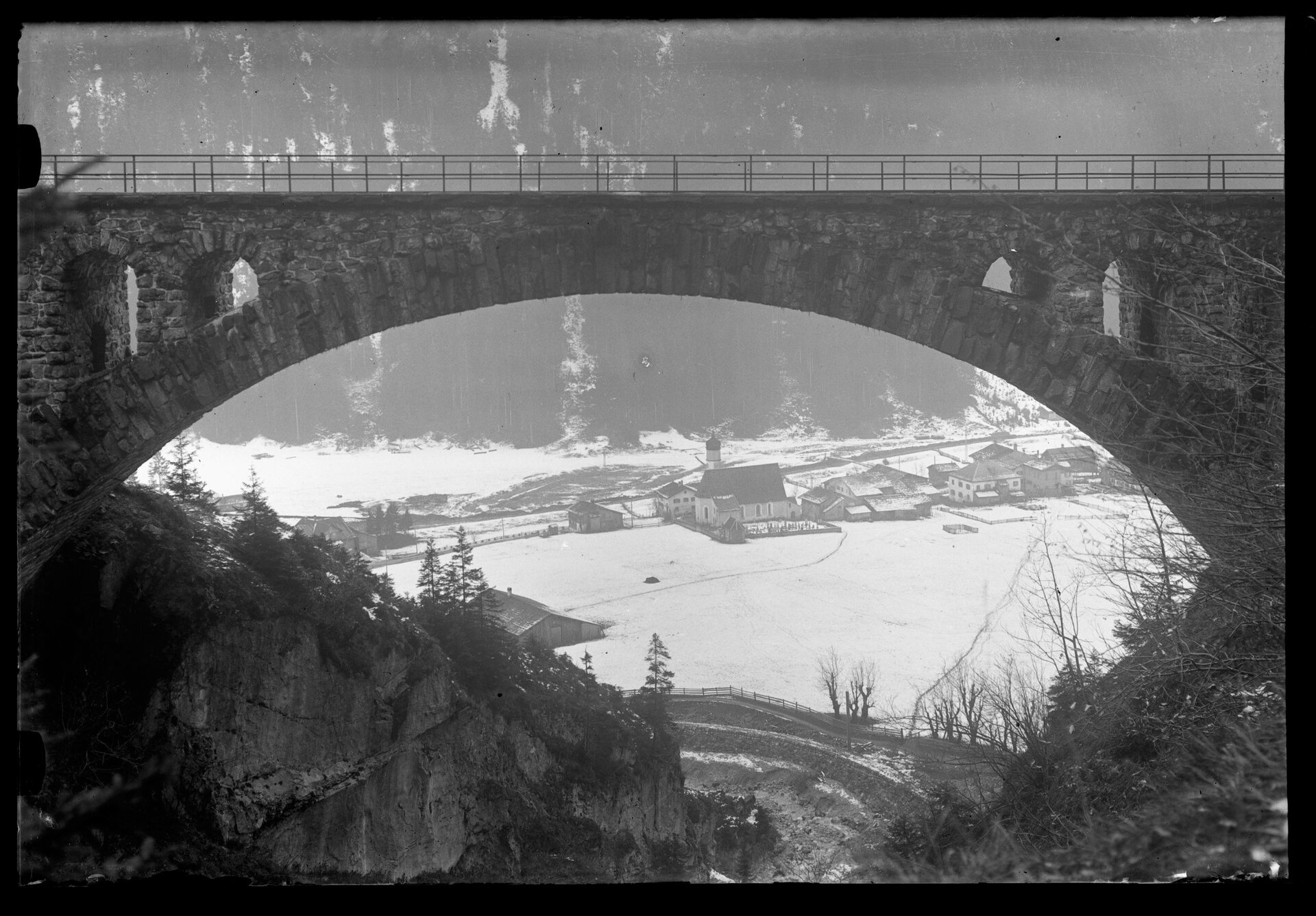
Station 8: Wädletobel Gorge
Named after a small forest
The geology of the valley is characterized by a striking tectonic boundary line that runs from the east south of the valley floor to Dalaas and forks here. The imposing limestones of the Northern Limestone Alps rise on the north side of the valley, while the crystalline rock of the Central Alps (Silvretta blanket) characterizes the landscape of the Verwall Group to the south. Several longitudinal valleys were formed at this geological boundary, of which the Klostertal lies in the far west.
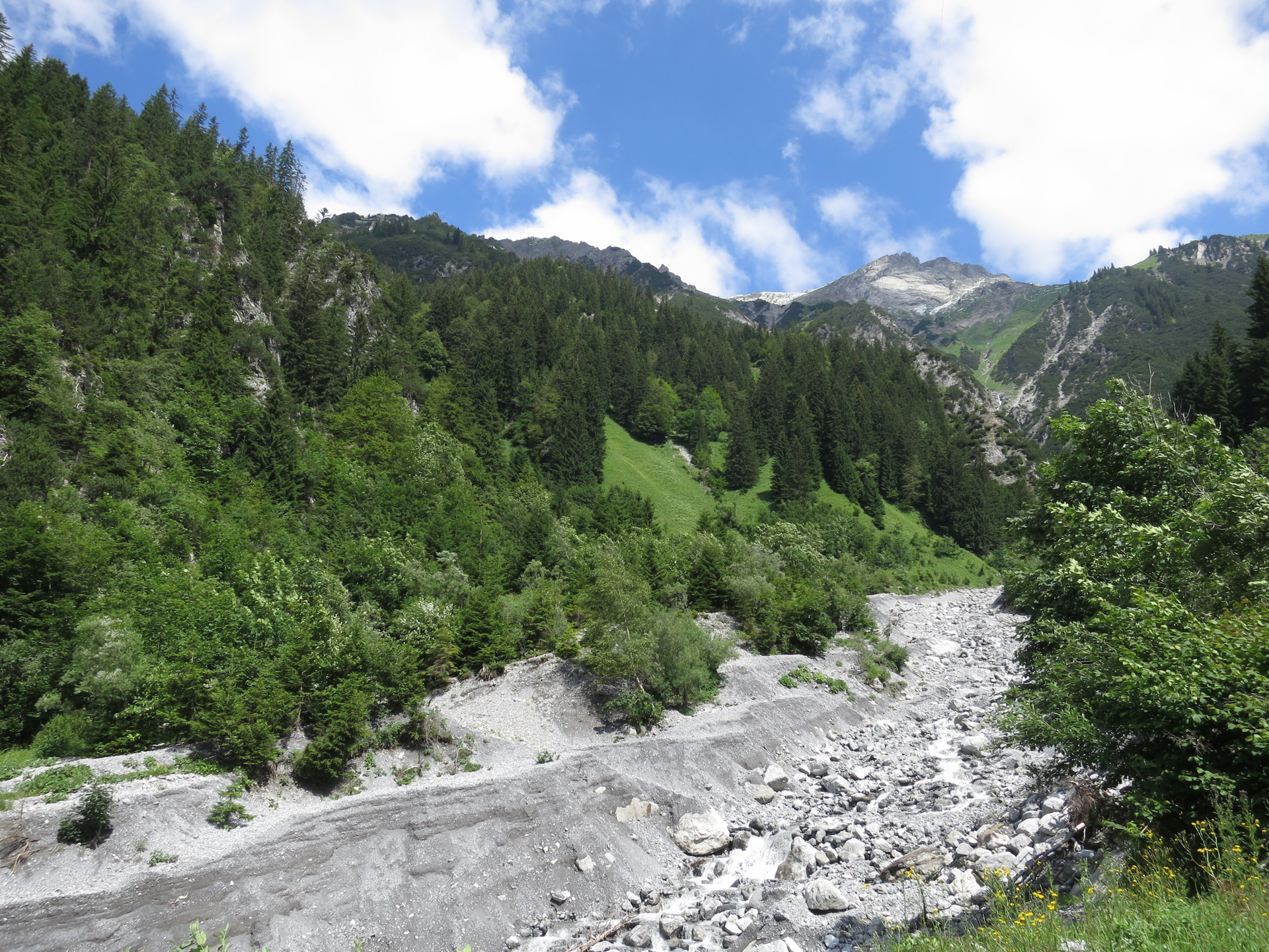
The Alfenz, which originates in Stuben am Arlberg from the merger of the Rauzbach and Stubenbach, flows through the Klostertal until it flows into the Ill between Bludenz and Lorüns. Its numerous tributaries along the sides of the valley have a steep gradient; some of them have formed striking waterfalls. The Wäldletobel with its gorge is an impressive example of this. The alpine landscape is also characterized by numerous mountain lakes, of which the Spullersee and the Formarinsee are the best known and largest.
The torrent, named after a small forest, is best known for the viaduct over which the Arlbergbahn used to run. The gorge can be walked through today. After debris flows, the ravine can become a raging torrent and cause massive destruction in a short space of time. This was last the case in 2010.