Ski Tours
Explore the white winter wonderland
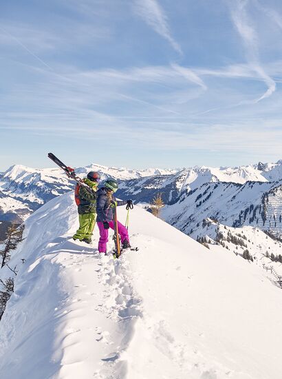
Explore the white winter wonderland in the UNESCO Biosphere Reserve Großes Walsertal on a ski tour and breathe in the cool mountain air - your ski tour group is sure to recharge its batteries on this day. You glide almost silently through the snow-covered landscape on your skis, the snow crunching with every step. You climb higher and higher, hairpin bend after hairpin bend, getting further and further away from the starting point. Once you reach the top, a panorama of peaks with snow-covered slopes rewards you for the energy-sapping ascent. Then a descent over hopefully untracked deep snow slopes awaits. This is pure bliss.
Safety first: Ski touring should be a shared experience. It is not advisable to go on a tour alone. And it's more fun together. If you would like to go on a tour with a professional guide, you can be guided by the ski tour guides in the Großes Walsertal.
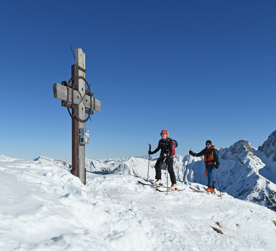
Up the Zafernhorn
On tour with an expert: summit bliss on the Zafernhorn in the Großes Walsertal.
Planning & Equipment
Careful planning is essential for a safe ski tour: find out about weather and avalanche reports and pack the right equipment - including an avalanche transceiver, probe, shovel and first aid kit. You will find everything you need in the sports stores and rental outlets in the Großes Walsertal.
Selected Ski Tours
Guggernülli 1.736 m | Marul
Starting point: Marul church, 8.9 km
Elevation gain: 760 m
Duration: 2.5 - 3 h
Difficulty level: easy
The tour starts to the left of Marul church and climbs up a steep slope. Before you reach the last houses in the village, keep right and cross the road. The first destination is the Stafelfederalpe at 1,472 m above sea level. Continue north and after approx. 300 m you will reach the ridge in the direction of Kellerspitze.
Descent: same as ascent
Glatthorn 2,133 m | Faschina
Starting point: Faschina village center
Altitude difference: 641 m, 3.2 km
Duration: approx. 2.5 h ascent
Difficulty: medium, difficult in the upper section
Refreshments available: Hotels and inns in Faschina, Franz Josef Hütte
Relatively short, but beautiful and not to be underestimated (summit ridge) ski tour. From the center of Faschina to the slopes to the west and over these to the Stafel Alpe and the so-called Glatthornbahn (4-seater chairlift). Shortly before the lift, turn left across the stream. Overcome the steep step at the start, which is covered in mountain pines, in a left-right loop and then easily reach the final slope via a ramp and up to the saddle on the south-west ridge. On the ridge, ski as high as possible, then walk the last few meters along the narrow ridge to the summit.
Zafernhorn 2,107 m | Faschina
Starting point: tunnel below the village of Faschina
Altitude: 783 m, 4.6 km
Duration: 2.5 - 3 h ascent
Difficulty: medium
Refreshments available: Hotels and inns in Faschina
The trapezoidal Zafernhorn, located to the east above Faschina, is often visited by ski tourers throughout the winter. The starting point is the tunnel below the village of Faschina (1,375 m). The tour leads along the forest path to the Zafera Maisäß huts.
From the Maisäß huts to the foot of the mountain and keeping slightly to the right towards a ramp that is also used as a summer path. Over this on the shoulder in the south-east ridge (chapel) and on the mostly blown-off grassy ridge to the summit. Caution: often large cornices on the right-hand side!
Descent: roughly the same as the ascent.
Lusgrind 2,286 m | Sonntag-Stein
Starting point: Sonntag-Stein cable car
Elevation gain: 1,243 m, 10.6 km
Duration: 5 h
Difficulty level: medium
Refreshments available: Inns in Sonntag, Seilbahn Stuba, Alpen Chalet Partnom
From Sonntag, take the cable car to Stein. From here, ascend into the valley towards Steinbild, Unterpartnom, Oberpartnom in a south-easterly direction to the Garmilsattel (1,810 m). Now take the goods road to the south-east, initially flat, then descending through the increasingly steep forest to the Laguzalpe (1,584 m). Continue in the direction of Obere Laguzalpe. Shortly before the Alpe, ascend to the Schwarze Furka and from there, first on skis, then on foot to the summit (1,140 m).
Descent: same as ascent.
Bratschenkopf 2,520 m | Buchboden
Elevation gain: 1,628 m, 8.4 km
Duration: approx. 5 h
Difficulty: difficult
Refreshments available: Inns in Buchboden
From Buchboden, the tour leads via Bad Rothenbrunnen up to the Gadenalpe (1,317 m) and further east to the Mutterwangjoch (2,025 m), descending a little to the east from the pass. From here you can climb the Bratschenkopf from the east. Follow the 2,000 m contour line eastwards under the rocks of the Bratschenwand to the Gamsboden. Climb up the eastern slope to the rarely climbed Bratschenkopf.
Descent: From the yoke or from the summit, keep left along the foot of the Feuerstein wall. Then the beautiful eastern slopes (be careful!) to the lower Alpschellenalpe and Metzgertobelalpe to Buchboden.
